AA Easy Read France Atlas 2026
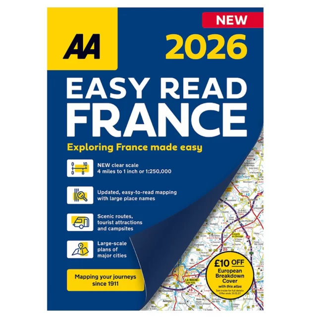
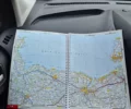
Plot the perfect French road trip – from Calais to Corsica—with the AA Easy Read France Atlas 2026. Newly created and updated for the 2026 season, this large-scale 1:250,000 road atlas is purpose-built for the British motorist in France: clear mapping, easy-to-read place names, and clever extras that turn planning into a pleasure. Expect smooth autoroutes, scenic detours, and plenty of café stops along the way.
Inside you’ll find terminal plans for Folkestone and Calais—ideal if you’re hopping the Channel Tunnel – plus an overview routes map to sketch the big picture before you zoom in. The atlas also includes full road coverage of Corsica, so island adventures are very much on the menu.
City-breaker at heart? There’s a two-page plan of central Paris and super-scale city maps for favourites including Bordeaux, Lille, Lyon, Marseille, Nice, Strasbourg and Toulouse – perfect for navigating museum runs, market mornings, and riverside strolls.
On the open road, handy symbology highlights scenic and tourist routes, toll vs. toll-free motorways, and places of interest—from national parks to ferry points. Practical markers help you choose the right road, including steep gradients, winter closures, and roads unsuitable for caravans. You’ll also find travel rules and driving info for Monaco and Andorra – useful if your itinerary nudges into the mountains or along the Med.
Why you’ll love it
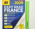
Easy-read pages + lie-flat spiral binding—plan with one hand, croissant in the other
Made by MairDumont, leading European cartographers—accuracy you can trust
Road-trip gold: campsites, petrol stations, golf courses, ferries and more are clearly shown
Perfect scale for touring – whether you’re chasing châteaux, surf, or snow
Specs at a glance: Publication date 1 June 2025; 248 pages; 350 × 240 mm (spiral). Built to ride shotgun in your glovebox and stand up to years of adventures.
If you like this, you'll love...